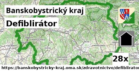
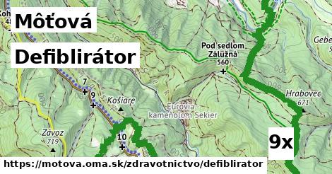
Defiblirátor, Banskobystrický kraj:, 1 z 3
defiblirátor, defiblirátor, defiblirátor, defiblirátor, defiblirátor, defiblirátor, defiblirátor, defiblirátor, defiblirátor, defiblirátor, defiblirátor, defiblirátor, defiblirátor, defiblirátor, defiblirátor, defiblirátor, defiblirátor, defiblirátor, defiblirátor, defiblirátor, defiblirátor, defiblirátor, defiblirátor, defiblirátor, defiblirátor, defiblirátor, defiblirátorDefiblirátor, Banskobystrický kraj:, 2 z 3
defiblirátor, defiblirátor, defiblirátor, defiblirátor, defiblirátor, defiblirátor, defiblirátor, defiblirátor, defiblirátor, defiblirátor, defiblirátor, defiblirátor, defiblirátor, defiblirátor, defiblirátor, defiblirátor, defiblirátor, defiblirátor, defiblirátor, defiblirátor, defiblirátor, defiblirátor, defiblirátor, defiblirátor, defiblirátor, defiblirátor, defiblirátorDefiblirátor, Banskobystrický kraj:, 3 z 3
defiblirátor, defiblirátor, defiblirátor, defiblirátor, defiblirátor, defiblirátor, defiblirátor, defiblirátor, defiblirátor, defiblirátor, defiblirátor, defiblirátor, defiblirátor, defiblirátor, defiblirátor, defiblirátor, defiblirátor, defiblirátor, defiblirátor, defiblirátor, defiblirátor, defiblirátor, defiblirátor, defiblirátor, defiblirátor, defiblirátor, defiblirátordefiblirátor inde
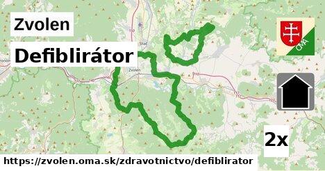
okres Zvolen (60x), Zvolen (21x), Môťová (9x), Horehronie (9x), Sliač (8x), Rybáre (6x), okres Brezno (6x), Hájniky (4x), Mikroregión Ekológ (4x), Mikroregión Pliešovská kotlina (4x), Mikroregión Podpoľanie (3x), okres Banská Bystrica (3x), Mikroregión Pozdola Bystrice (3x), Lešť (3x), Kováčová (3x), Budča (3x), Mikroregión Sitno (3x), Mikroregión Adela (3x), okres Banská Štiavnica (3x), okres Detva (3x), Vidov Vrch (3x), Mikroregión CHOPOK - JUH (2x), Banská Štiavnica (2x), Mikroregión Starohorská dolina (2x), Podjavorie I (2x), Sielnica (2x), Mikroregión Severné Podpoľanie (2x), Lieskovec (2x), Ostrá Lúka (2x), Očová (2x)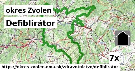
Podobné, Banskobystrický kraj:
165x lekáreň, 119x ordinácia, 81x defiblirátor, 23x poliklinika, 22x zubár, 20x nemocnica, 19x veterinár, 6x zdravotnícke pomôckyHľadáme defiblirator, OSM tagy: emergency = 'defibrillator'.